An Introduction to Spatial Data Science with GeoDa av Luc (University of Chicago) Anselin
979,-
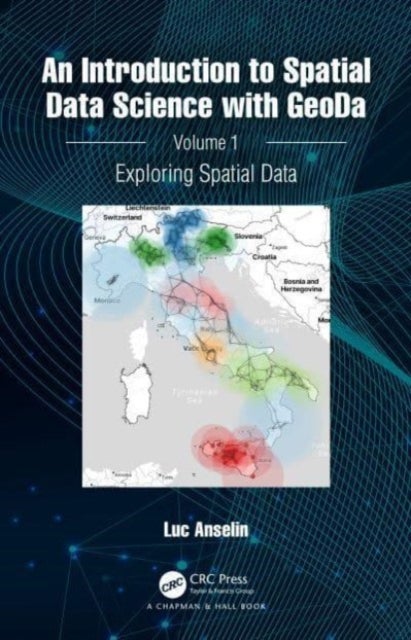
<p>This book is the first in a two-volume series that introduces the field of spatial data science. It offers an accessible overview of the methodology of exploratory spatial data analysis. It also constitutes the definitive user¿s guide for the widely adopted GeoDa open source software for spatial analysis. Leveraging a large number of real-world empirical illustrations, readers will gain an understanding of the main concepts and techniques, using dynamic graphics for thematic mapping, statistical graphing, and, most centrally, the analysis of spatial autocorrelation. Key to this analysis is the concept of local indicators of spatial association, pioneered by the author and recently extended to the analysis of multivariate data.</p><p> </p><p>The focus of the book is on intuitive methods to discover interesting patterns in spatial data. It offers a progression from basic data manipulation through description and exploration, to the identification of clusters and outliers by means o

Relaterte produkter
Vis flereVi har valgt ut en rekke interessante produkter i samme kategori som An Introduction to Spatial Data Science with GeoDa av Luc (University of Chicago) Anselin. Hvis du ikke finner noe interessant her kan du enkelt klikke på “vis flere”.


Produktinformasjon
- Alle prisene nevnt ovenfor er oppgitt i Norske kroner.
- Dette produktet er tilgjengelig hos Norli NO.
- Hos Norli NO kan du kjøpe An Introduction to Spatial Data Science with GeoDa av Luc (University of Chicago) Anselin for kun 979,-.
- Den laveste prisen på An Introduction to Spatial Data Science with GeoDa av Luc (University of Chicago) Anselin ble registrert 17. februar 2025 kl. 14:48.
Prisutvikling
Er den nåværende prisen et godt tilbud?
Grafen over prisutviklingen viser den laveste prisen over tid, eksklusiv fraktkostnader.
Prishistorikk for An Introduction to Spatial Data Science with GeoDa av Luc (University of Chicago) Anselin
Laveste pris
979,-
17 feb. 2025
Høyeste pris
979,-
17 feb. 2025