2025 Philip's Road Atlas Britain and Ireland av Philip's Maps
249,-
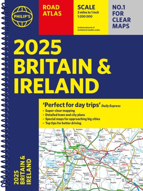
<p><b>''Good balance between detail and clarity with excellent town maps'' </b><i><b>What Car?</b></i><br><b>PHILIP''S - Market leader and No. 1 in the UK for clear maps </b><i>2025 Philip''s Road Atlas of Britain and Ireland </i>is a top-of-the-range, A4-sized, spiral-bound atlas, featuring fully updated maps from the Philip''s digital database. Voted Britain''s clearest and most detailed in an independent consumer survey, the mapping is super-clear.<br><br>* 160 pages of fully updated super-clear road maps<br>* Top tips for better and safer driving and the easiest way to parallel park <br>* Detailed route-planning maps, to help plan your route in advance<br>* 88 fully indexed and detailed town-centre maps throughout the British Isles<br>* Major city approach maps with named arterial roads including the expanded London ULEZ<br>* Clear road map showing all of Ireland <br><b>*</b> Mapping at a scale of 3 miles to 1 inch = 1:200,000 for easy use<br><b>* </b>Handy lie-flat spiral format<b

Relaterte produkter
Vis flereVi har valgt ut en rekke interessante produkter i samme kategori som 2025 Philip's Road Atlas Britain and Ireland av Philip's Maps. Hvis du ikke finner noe interessant her kan du enkelt klikke på “vis flere”.


Cap sur... 1
463,-
Produktinformasjon
- Alle prisene nevnt ovenfor er oppgitt i Norske kroner.
- Dette produktet er tilgjengelig hos Norli NO.
- Hos Norli NO kan du kjøpe 2025 Philip's Road Atlas Britain and Ireland av Philip's Maps for kun 249,-.
- Den laveste prisen på 2025 Philip's Road Atlas Britain and Ireland av Philip's Maps ble registrert 17. februar 2025 kl. 14:48.
Prisutvikling
Er den nåværende prisen et godt tilbud?
Grafen over prisutviklingen viser den laveste prisen over tid, eksklusiv fraktkostnader.
Prishistorikk for 2025 Philip's Road Atlas Britain and Ireland av Philip's Maps
Laveste pris
249,-
17 feb. 2025
Høyeste pris
249,-
17 feb. 2025